Hi again people and pooches. Me and my human personal assistant have just returned from one of our regular walks around Ruabon. We recently posted a blog about the Ruabon Conservation Area, so we thought that we would post one about some of the other interesting parts of the village. We have not included the parts of Ruabon in this blog that we have already posted about. I have included a link to our Conservation Area blog.
https://joethecockershikes.com/2024/03/07/ruabon-rhiwabon-conservation-area/
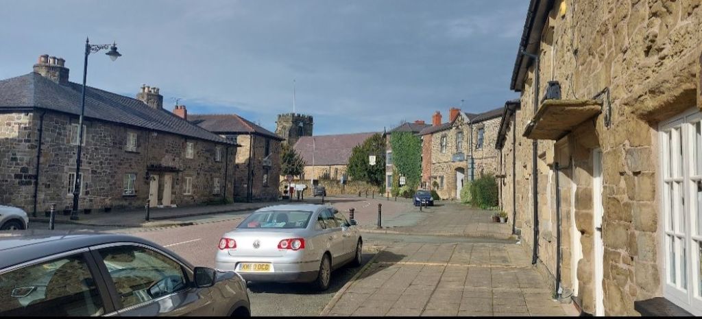
Park Street, looking back to the pub and St. Mary’s Church.

We started our walk at the Wynnstay Arms and walked along Park Street until we crossed the road bridge over the A483. Immediately after the bridge, on the left, there is a marked footpath along the rear of the houses. This was my time to have a run around off-lead. So, after a good sniff around in the bushes and watering the daffodills, I found myself back on-lead. We left the footpath at a right turn to emerge into Vicarage Fields.
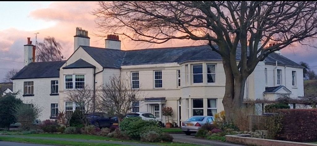
After walking around the pavements, we left the houses behind at the junction with the A539. We had just passed The Old Vicarage on our left. This is the birthplace of Major Walter Clopton Wingfield, the “inventor” of lawn tennis. He patented the rules and wrote the first rulebook of the game that he called Sphairstike.
We headed back over the duel cariageway to the Wynnstay Arms to cross over the road into Church Street.

The narrow road leads downhill to Pont Adam, the bridge over the Afon Eitha that winds its way through the village.
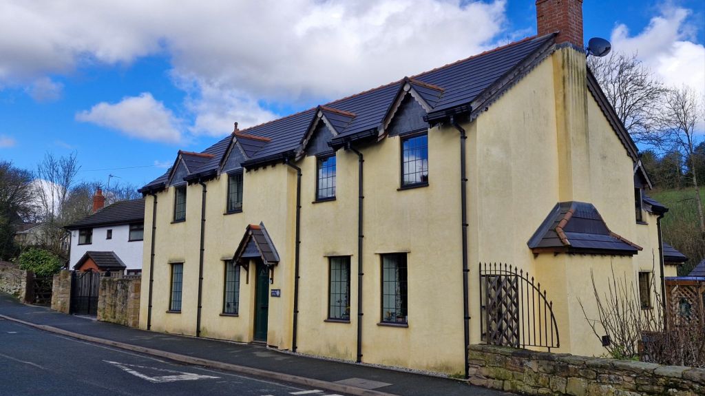
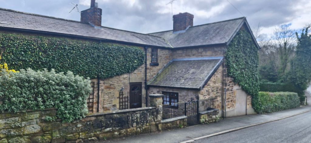
As we passed over the bridge, we came to Bridge End Cottage, an Eco Convertion, and renovation of two cottages into one family home.
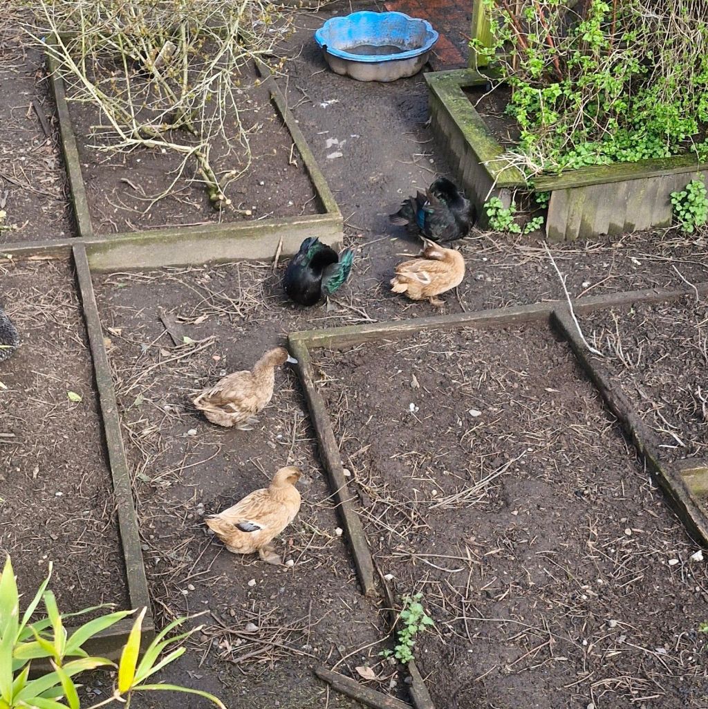
As I am an inquisitive pooch, I couldn’t help looking over the garden wall at the clucking chickens below.

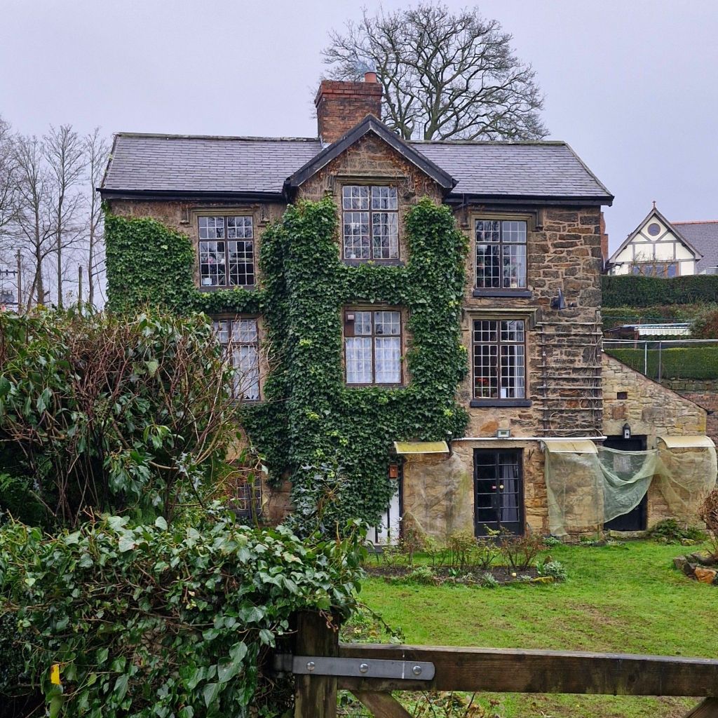
Opposite Bridge End Cottage is Pont Adam Crescent. After fifty yards or so on the right is probably the oldest house still standing in Ruabon village. It is a large H-plan house dating from the early to mid 16th century.

Sadly, the house is in very poor condition, and the relatively recent renovation and reconstruction have stalled.
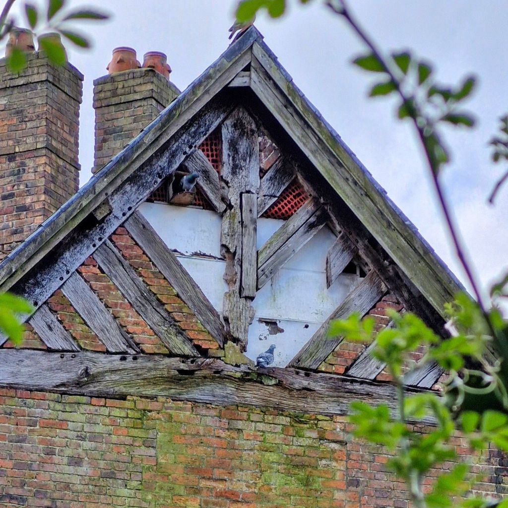
Some of the original structure can still be seen through the overgrown gardens.
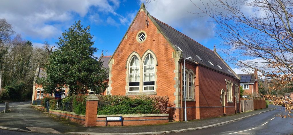
We left Pont Adam and headed left uphill to the Old Grammar School, which is currently residential. The original grammar school is in Church Street. This one was built to replace that one due to outgrowing the Church Street school.
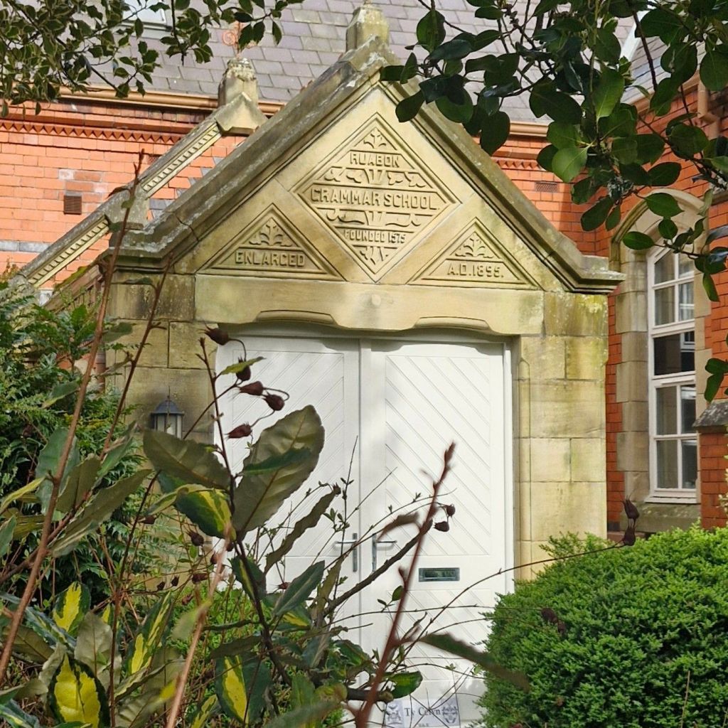
Plenty of the original features of the school remain as the building is Grade ll listed.
I wanted to turn left at the road junction so that I could have a blast along Offa’s Dyke and to rearrange a few sticks in the woodland. This time we turned right into Tatham Road. I did get to sprint along the side of the football pitch and to sniff at all of the molehills that have recently appeared. At the corner of the field we dropped down a slippery slope to head along the road again.
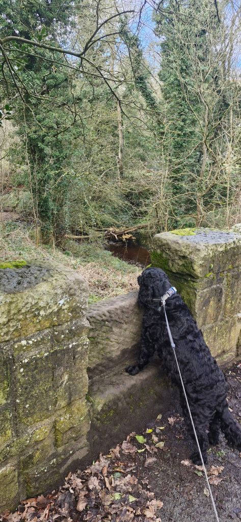
After a hundred yards, we reached an old stone bridge over the Afon Eitha. I wanted to climb over the dropped wall to the footpath so that I could have a splash in the river. My human was being a killjoy and refused my appeal. So, we headed up the slight incline along Tatham Road.
On the right is Offa Cottage, a three storey stone building.
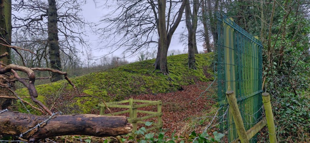
On the left, there is a short lane leading to Pen y Gardden Hillfort with a number of local red brick houses.
As we reached the top of the incline on Tatham Road, we passed the farm buildings and cottages of Tatham Farm.

On the right of the road, there is an information board describing the history of the area. Tatham Road runs parallel alongside Offa’s Dyke. The former boundary between Mercia and Powys, England and Wales. At this point it can be seen over the fence. Originally, it would have been over 8 feet high and over 60 feet wide and stretching for 82 miles.

Pen y Gardden hall can be seen across its grounds on the left of the road.
My human found another good view of the dyke at the bottom of the hill by peering over a fence.

At the entrance to the Gardden Industrial Estate, a coal-mining truck is positioned to commemorate the mining industry in the area.

At the road junction, we turned right along Ruabon Road to take us back into the village. Hidden by bushes and trees on the left is Monks Pool, the remaining clay pit from the Monks and Newell Clay Works.
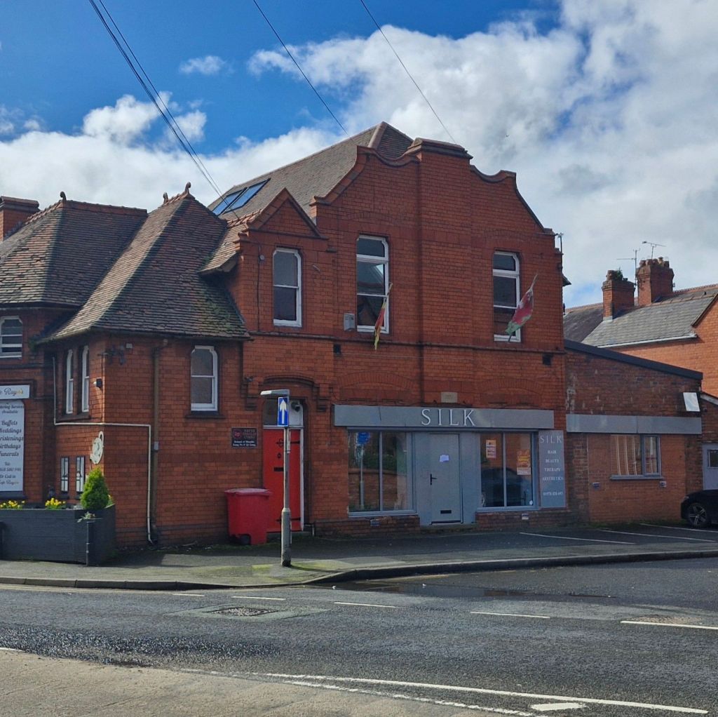
We headed towards the village along Ruabon Road as we passed Wynnville and came to the old Police Station and courtroom. It is currently occupied by Silk Hair and Beauty and Cafe Rayos. Built in 1896 and from local red brick and was used as a police station until 1967.

Part of the building is also residential.
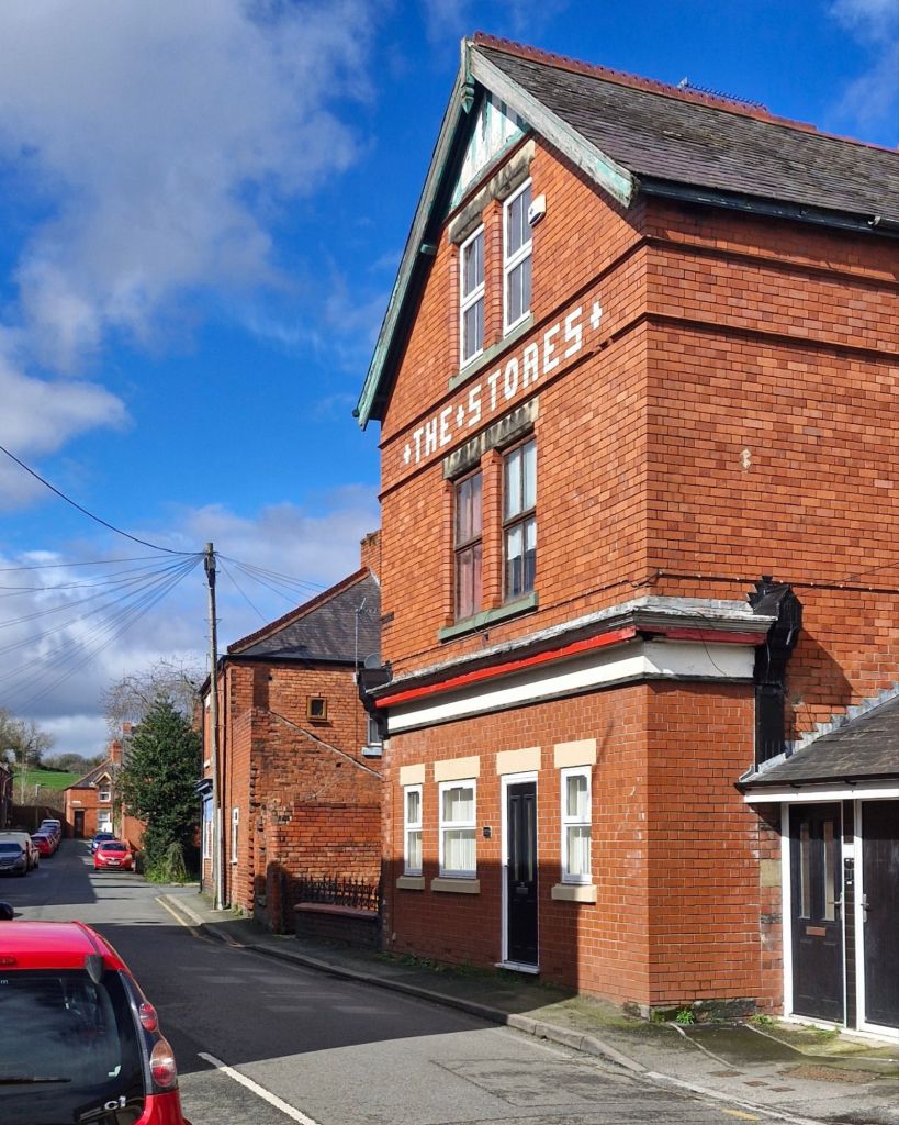
A few yards along New High Street is a right turn into Henry Street. The Stores, a Victorian brick building that has been converted from a shop to a residential property.
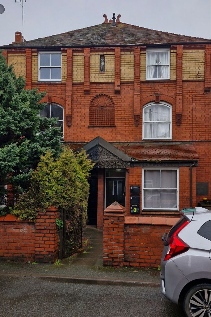
Opposite The Stores is the Grade ll listed Oaklands. It was built in 1895 from Ruabon brick.
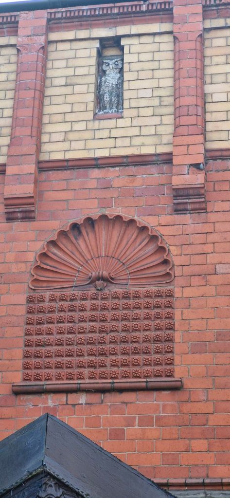
The front of the building is adorned with a terracotta plaque with a shell and rows of rosettes below a figure of an owl.
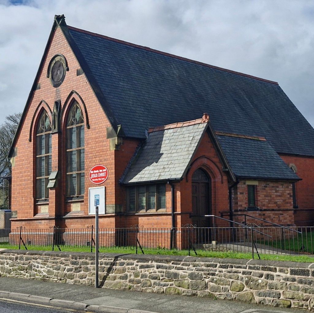
We ended our walk at the corner of Henry Street and New High Street. Built in 1892, Ruabon Methodist Church was originally the Primative Methodist Sunday School.
We plan to write about more of our walks in the area. Till next time!

hello I was born in ruabon in 1953. My nian had a little shop next to the co-op. Would it be possible on your travels to take a photo please. I am living in Australia and have enjoyed your walks around my village. Thanks Lyn 🙋♀️😊🏴🇦🇺
LikeLike
Certainly. I’ll take one tomorrow 👍
LikeLike
Do you have WhatsApp, Messenger or email that I can send the photo on?
Cheers
Joe the Cocker
LikeLike
Thanks Joe for more interesting facts about Ruabon.
LikeLike
Thank you for reading 👍👍🐕
LikeLike