Hello again people and pooches. Joe the Cocker here. Me and my human walk around Ruabon’s streets every day. We have been on some muddy walks latey so the big feller suggested a walk around Ruabon’s Conservation Area where we would be sticking to the pavements. The area covers some of the older parts of the village. I have included a link to Wrexham.gov.uk to a description and map of the area. I am not going to go into depth with descriptions of all the buildings in the area because this would be a massive undertaking. My aim is to highlight some of the fascinating buildings in the village and to encourage everyone to walk around the area. We are relative newcomers to the village, and we love it. We plan to write a blog about other parts of the village as soon as we can.
https://www.wrexham.gov.uk/service/conservation-areas/ruabon-conservation-area

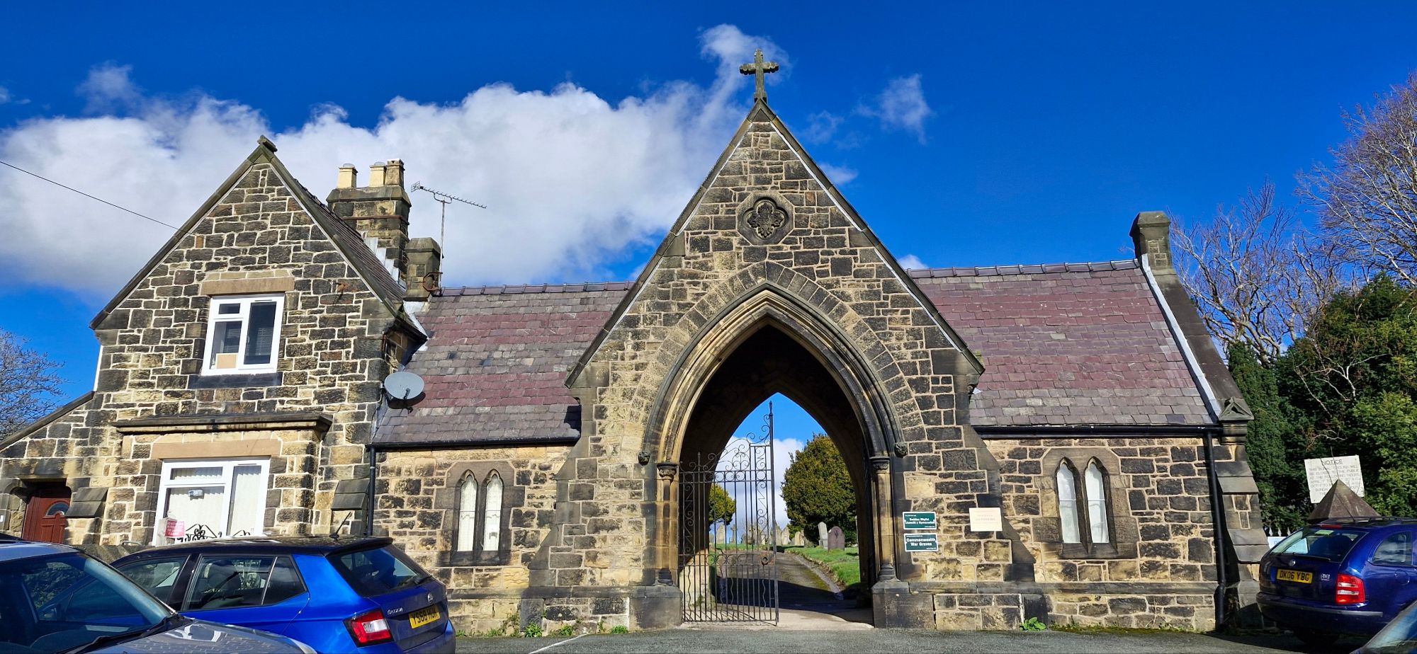
We started our walk at the most prominent landmark in the village. St. Mary’s Church deserves a close look. I have not been inside the building because I’m a canine, but all you humans should visit the church at some time. The lych gate is a stunning entrance to the churchyard. It commemorates the local fallen in the two world wars.

The War Memorial obelisk that stands in the churchyard is in memory of the alumni of Lindisfarne College who died in the world wars. Lindisfarne College of Essex relocated to Wynnstay Hall after the Second World War. When the college closed in the 1990s, the memorial was moved to its current position from Wynnstay Hall.
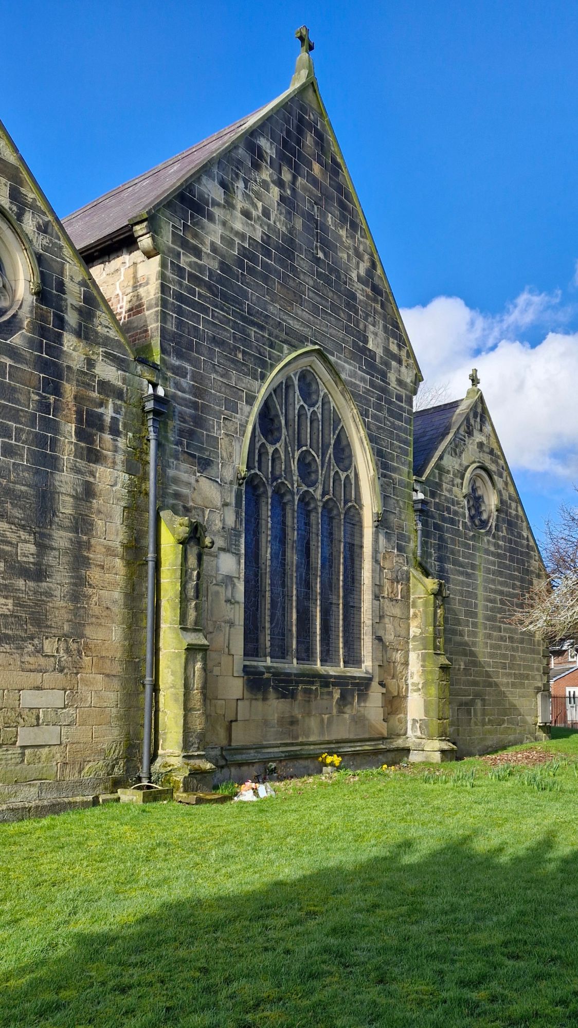
The stained glass windows of the church and the architecture are beautiful and deserve more than a fleeting glimpse.

The 14th century tower dominates the skyline for miles around, with the bells being added to and recast in.1768. The bells sound every 15 minutes with a full peal sounding at 9am on Sunday, calling parishioners to the service.
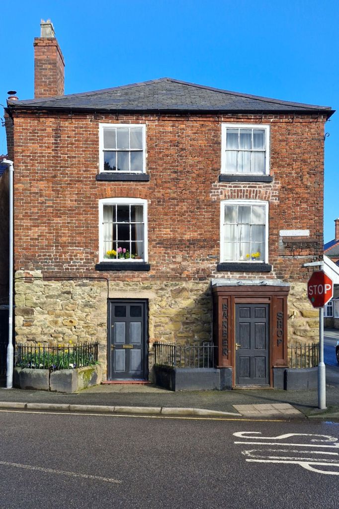
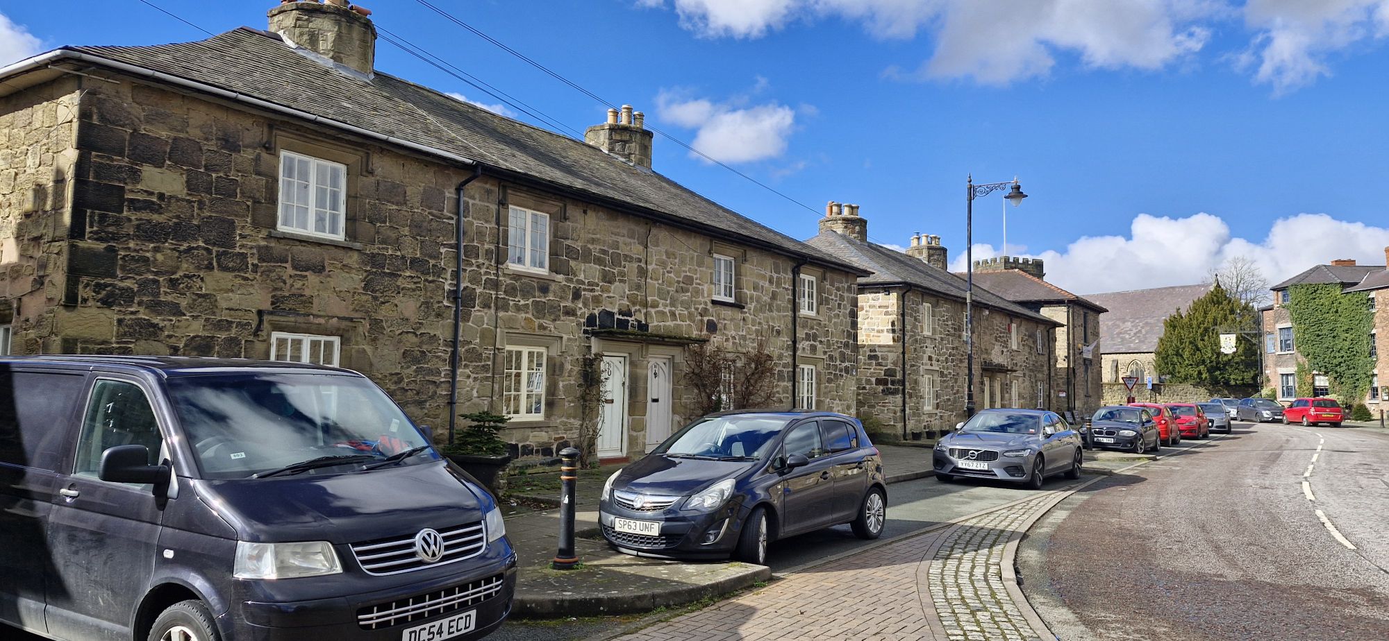
We left the church grounds through the lyche gate. Directly opposite is Mary’s Salon, which is currently an established Barber Shop.

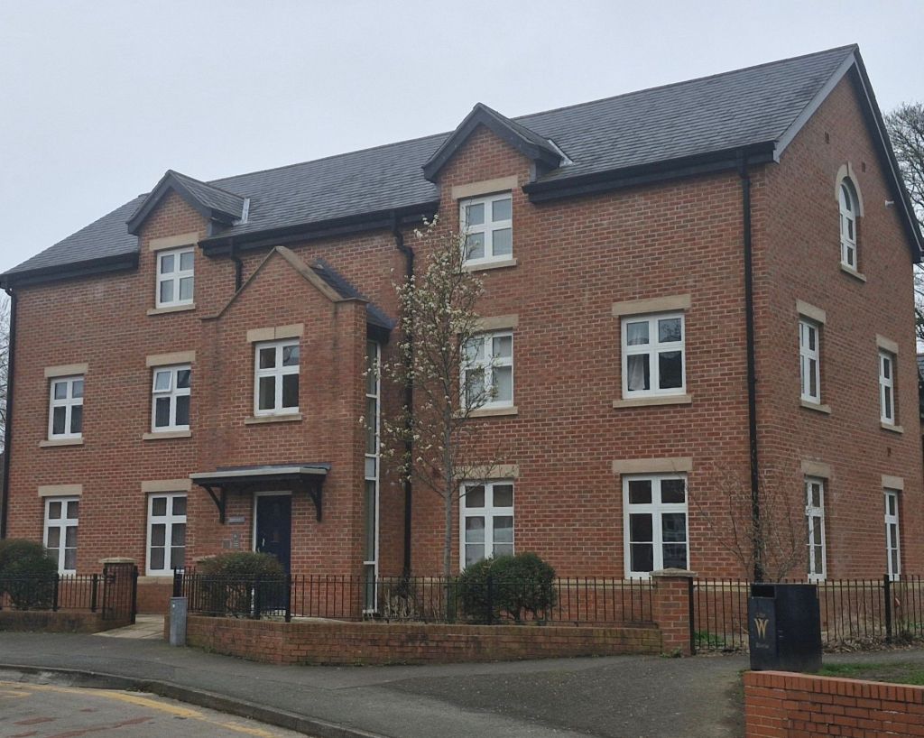
To the left of Mary’s Salon stands Exchange Buildings or The Exchange as it was once known. It is currently being renovated.
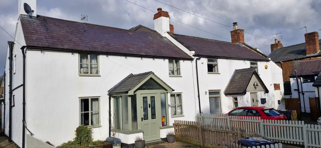
Next door are two cottages that were once part of the Old Cross Foxes Inn. One bears the pubs name, with the other called The Nook. The pub closed over 120 years ago.
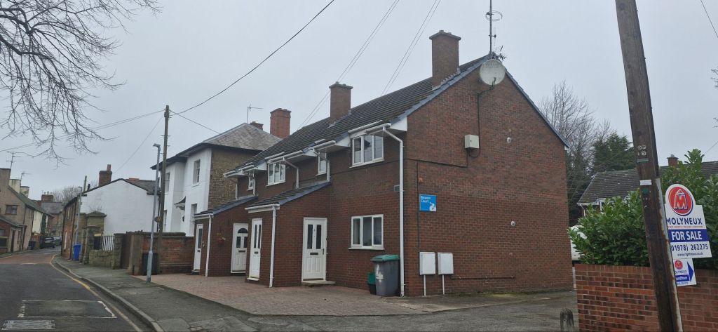
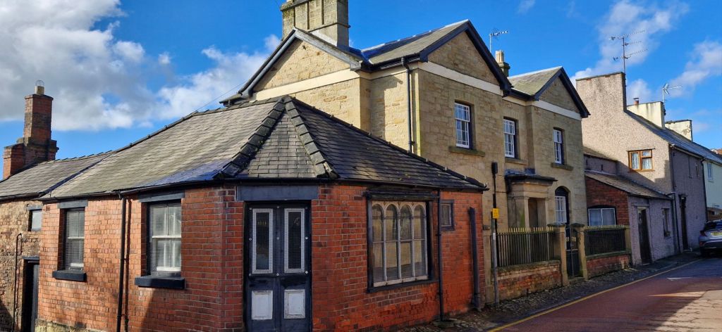
Across from Bowen Court, the modern flats is the Hearse Shed, which is attached to The Old Grammar School.
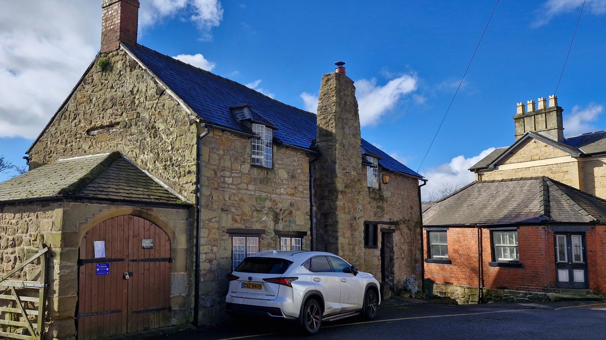
The school was constructed in 1632 and incorporates parts of an older building founded in 1575. It was known as an Endowed Grammer School due to its reliance on endowments made to keep it running. Since its closure in 1837, it has been used,in part, as a shop until its convertion to a residential property.
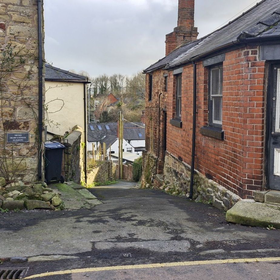
The steep lane at the side of the Old Grammar School, Ysgoldy Hill, leads to the side of the Bridge End Inn.
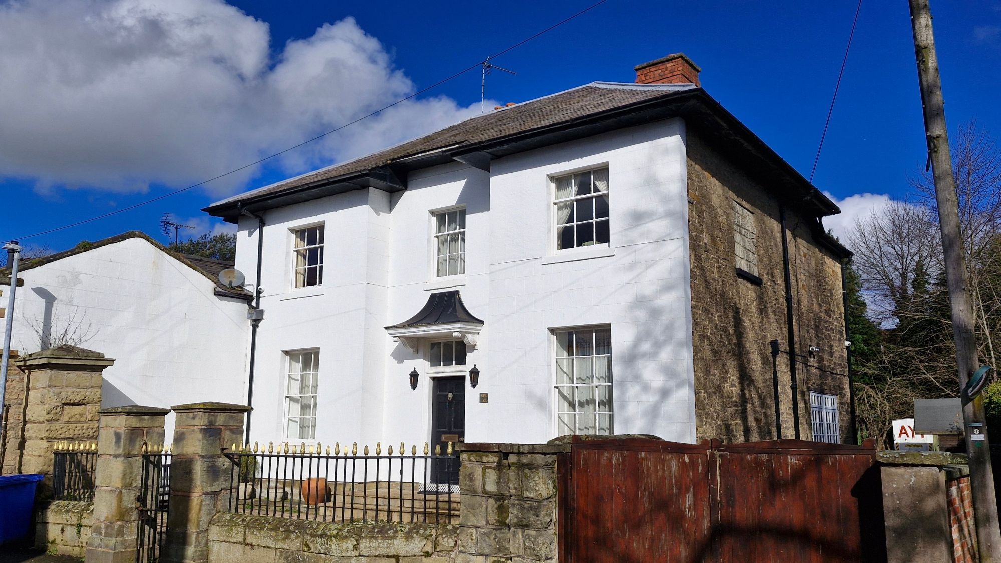
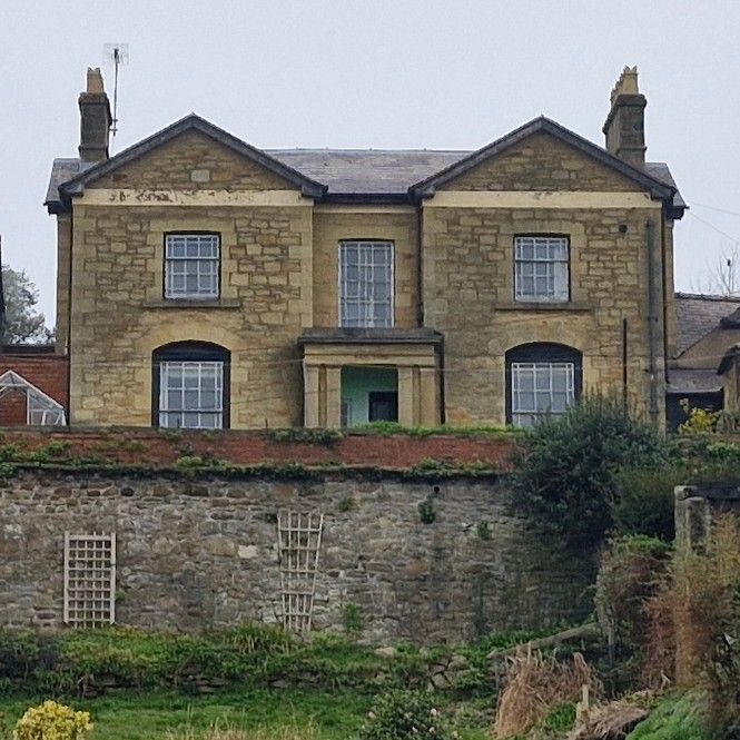
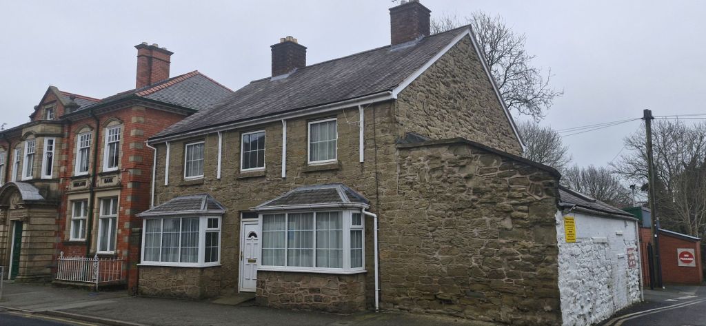
Directly opposite the school is Spring Lodge. The house was built in the early 19th century and was the offices of the Wynnstay Estate. It is currently residential.
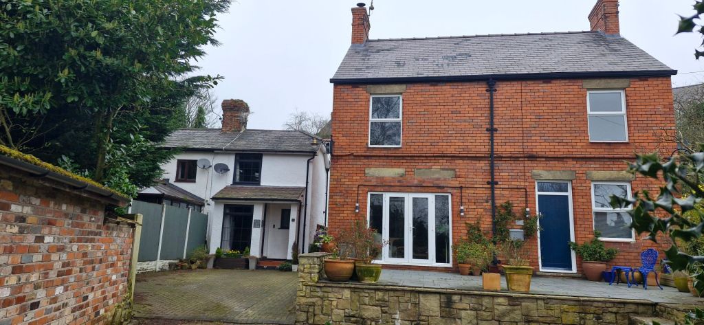
As we slowly moved along Church Street, we came to Stonehurst. This is another early 19th century set slightly back from the narrow road. The red brick building attached to the house was once a sweet shop.
The rear of Stonehurst is as grand as the front.

Cambrian Cottage and Cambrian House, built in 18th century, are directly opposite Stonehurst at the narrowest part of the street.

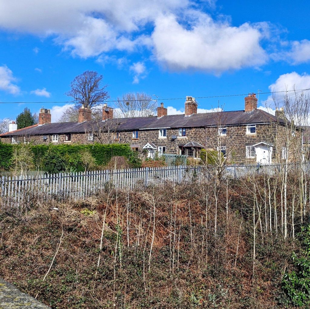
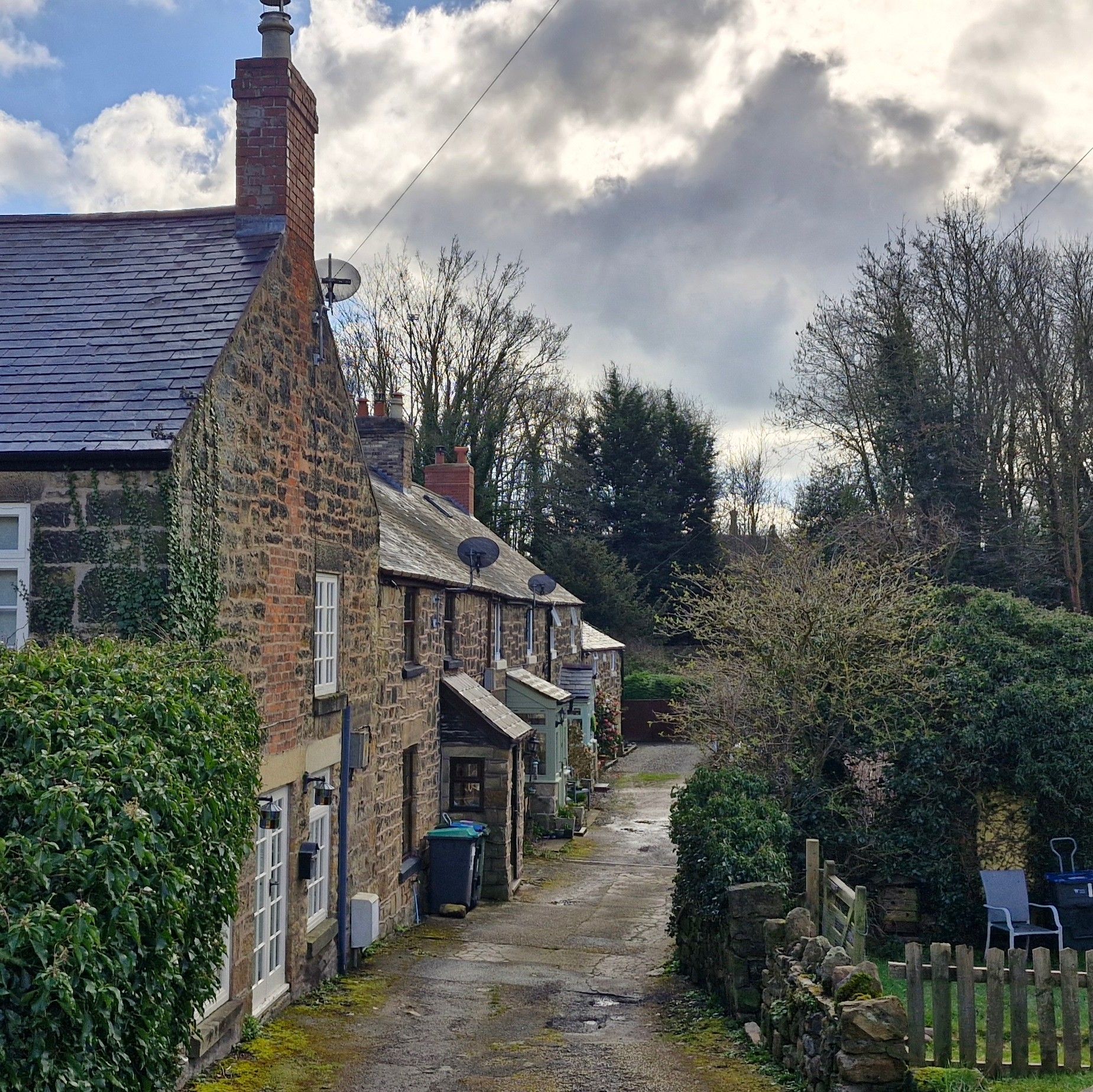
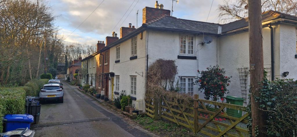
Further along Church Street is a row of cottages, 1 to 5 Church Street, that were originally used as stables. The end cottages are currently being renovated.
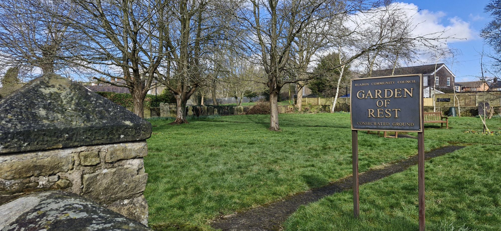
Directly opposite the cottages is the Garden of Rest. When the boundary wall of St. Mary’s Church was moved back in 1970 to widen the road, the gravestones were relocated to the Garden of Rest, and are lined against the perimeter wall.
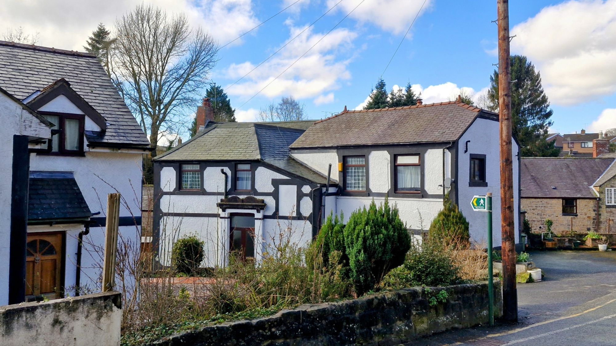
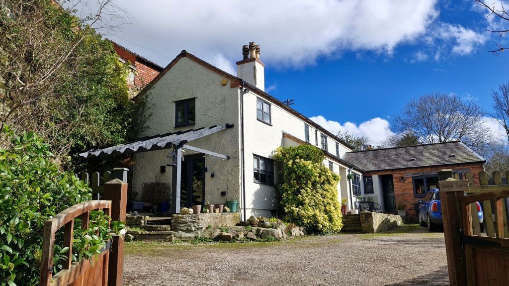
On the left is Mount House, just before the bridge over the railway.
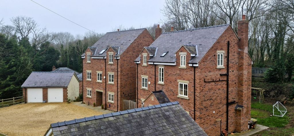
A couple of relatively new three storey houses have been built in the hollow beside Mount House.

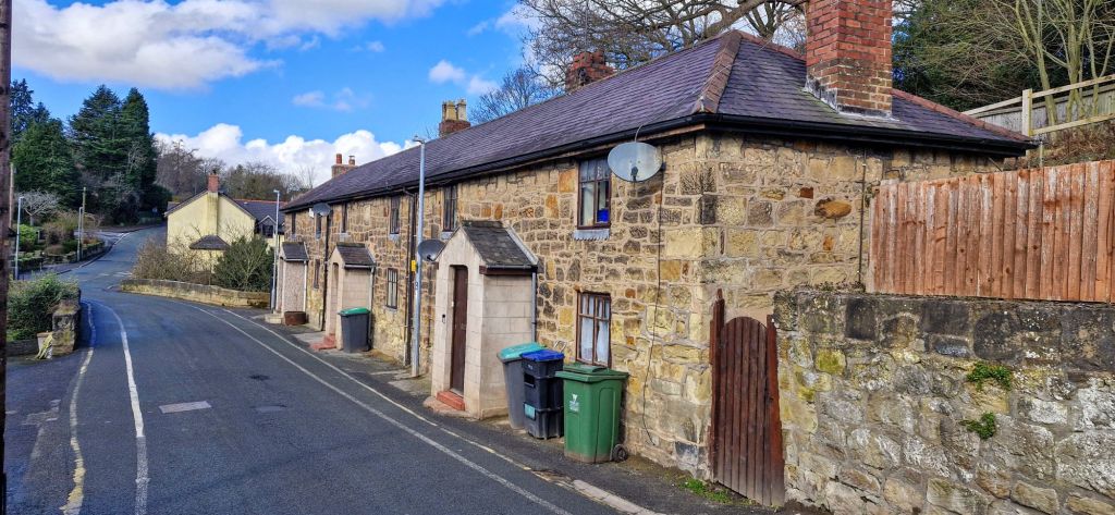
The Almshouses are next to the Garden of Rest and were built to house the poor of the parish in 1711 by the local vicar, John Robinson. They are the only remaining buildings that surrounded a courtyard on three sides.

After crossing the railway bridge, ahead is the English Congregational Church known as the Church on the Mount. It was built in 1858 and designed by William Ithell Mason of Liverpool.
The row of houses on the crest of the hill is known as Mount Pleasant. Lovely views across the countryside can be had from the cottages. I am told that Chirk Castle, the Wynnstay Estate, and Wynnstay Column can be seen in the distance.
Heading uphill by Mount Pleasant is the lodge entrance to Ruabon Cemetery with its six Commonwealth war graves.
We retraced our steps to turn right, heading downhill towards Pont Adam. We followed the tall sandstone church boundary wall downhill. There is a row of stone built cottages on the right with the bridge over the Afon Eitha ahead. A marker stone has ‘WWW’ engraved on it. The initials of Sir William Watkin-Wynn, a major land and property owner in the area, with a very colourful history.

The original stone bridge was constructed in 1479, with the current one built in 1894. It spans the Afon Eitha below.
Opposite the Pont Adam cottages are the buildings that housed the Nant Inn / Great Western Inn. The timber framed building is now residential.

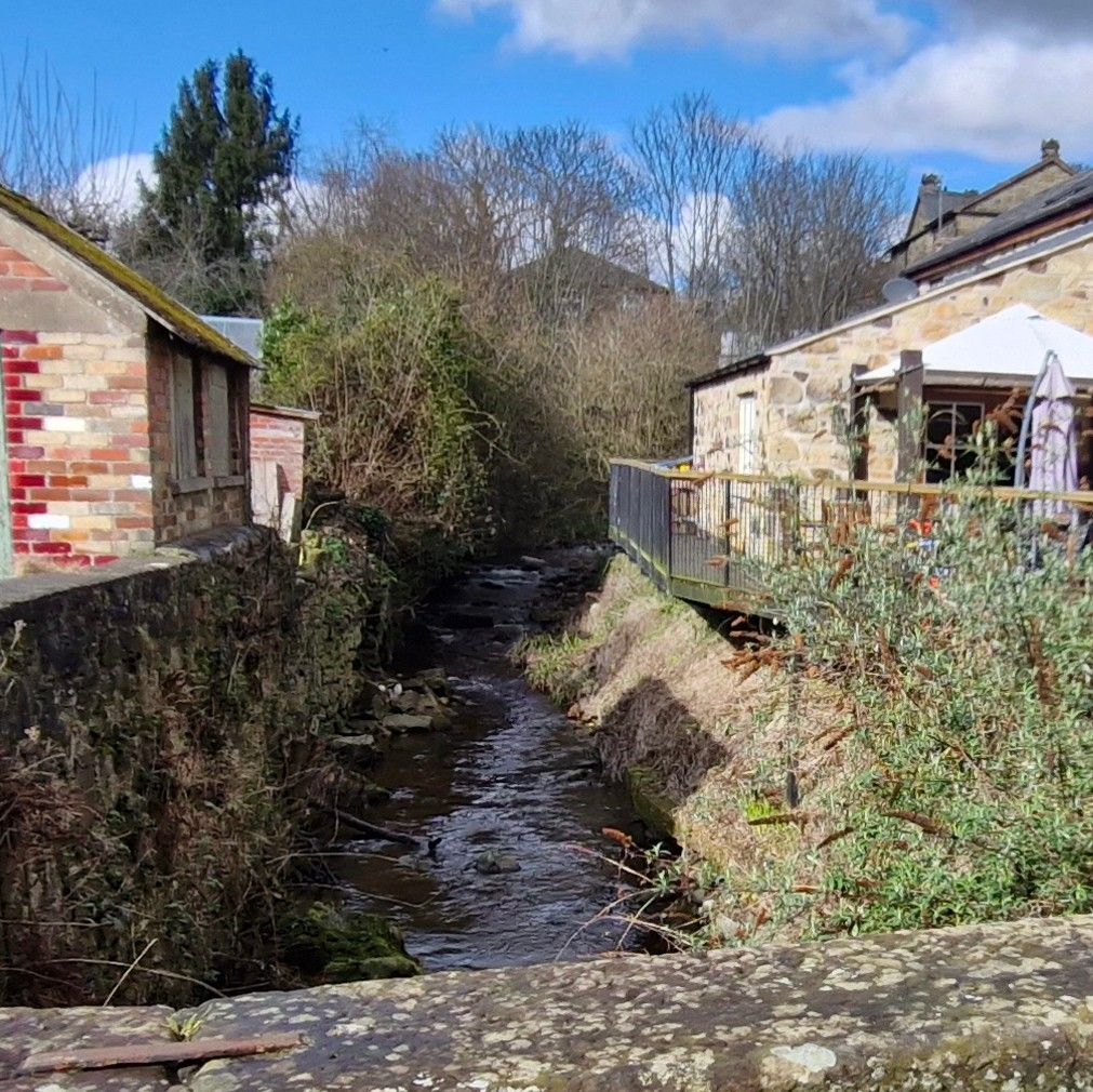
The river passes under the bridge and then flows between the old pub and West End Terrace, a row of cottages in a narrow lane.

We passed Corner Cottage as we crossed the bridge. The cottage is joined to West End Terrace at the rear. It is a single storey at the front with three storeys at the rear.
West End Terrace is a cul-de-sac with a rough road surface in a very quiet area, with gardens on the opposite side of the lane.

We headed back over the bridge where we turned right along the Public Footpath at the side of the old pub. Nant y Gwalia, the red brick cottages are on the right.

The path turns right immediately before Brookside, on the site of a gasworks. The building is unusual with two wings and a central rounded section with a conical roof.
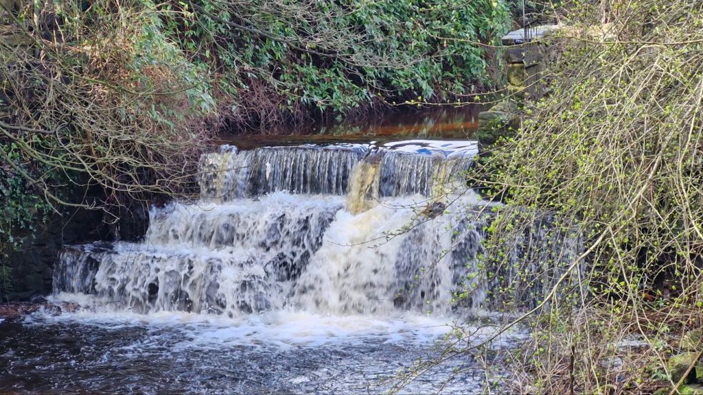
We passed the weir or waterfall and continued over the footbridge.
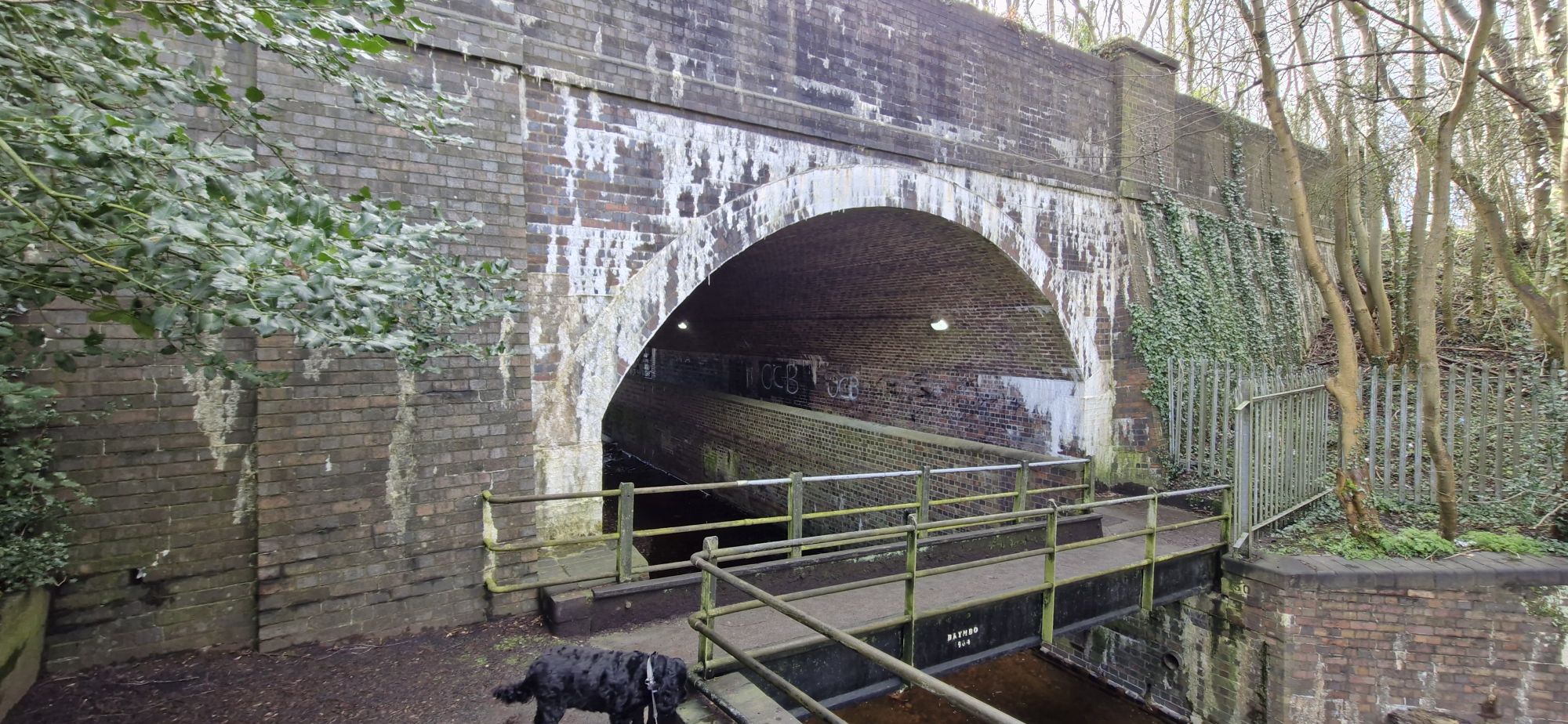
We crossed the steel footbridge over the river and under the road bridge.

This brought us to Ruabon Railway Station. The station is unmanned, and the station buildings are currently being renovated and converted to a residential house.

On the left, as we walked down Station Road is a small development of houses in Millbrook tucked in between the road and Afon Eitha.
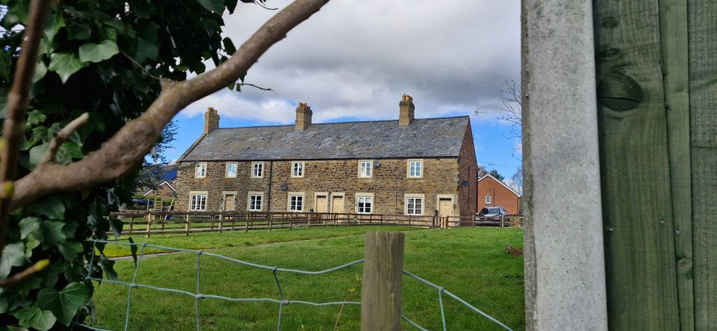
We headed down Station Road and turned right at the main road. After 100 yards on our right, we could see a row of cottages with long front gardens. Grenville Terrace is a row of four houses on the edge of the Conservation Area.

We crossed the B5605 and headed back to turn right into Duke Street. On the right is the English Wesleyan Methodist Church. The late 19th century building is currently closed and boarded up.
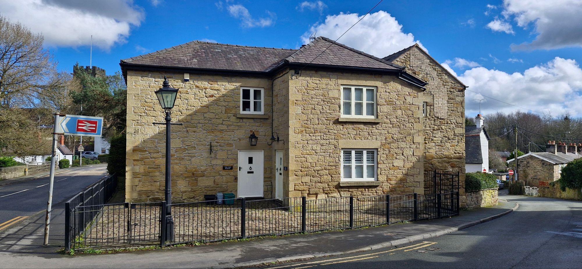
The Old Bakery stands on the opposite side of the road.

We walked downhill into Duke Street. A very narrow steep bridge into Tan y Lan is at the end of the street, over the Afon Eitha.
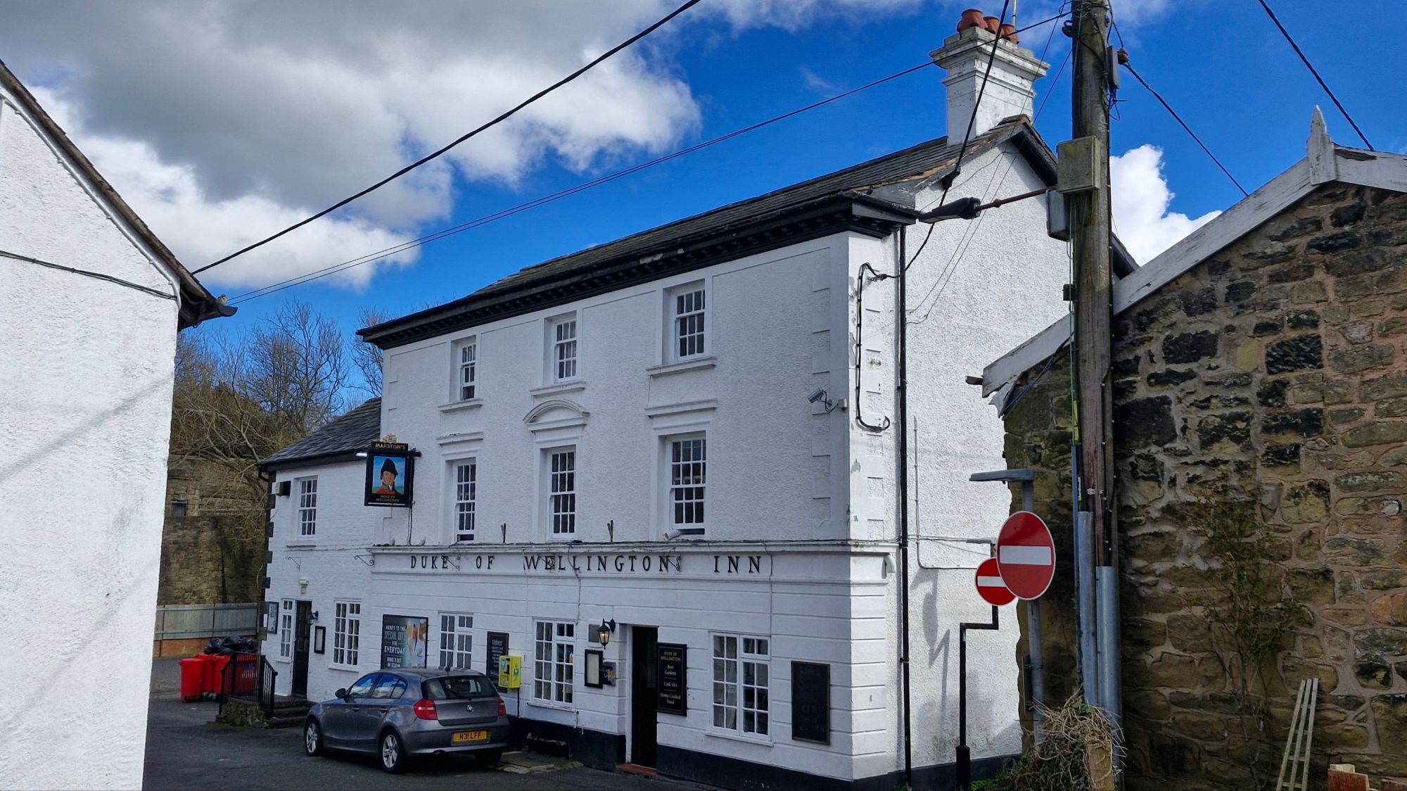
The Duke of Wellington is one of three local pubs within 100 yards or so.

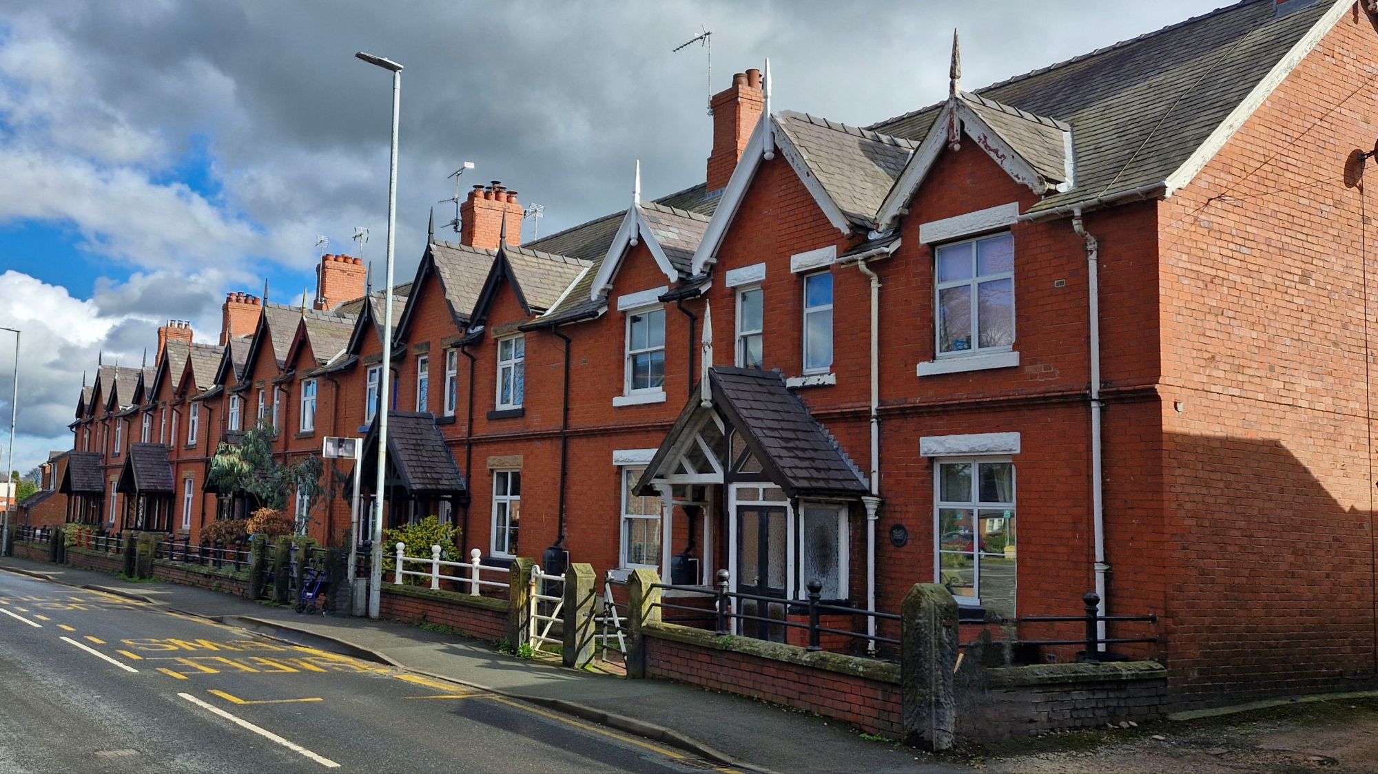
We walked along a narrow lane between The Duke and a long terrace of houses in Paddock Row. The row was built in the 1880’s as stables for Sir Watkin Williams-Wynn.
The road bears left after the row of houses to cross over a stone bridge over the river.

Llys y Nant is on the right.
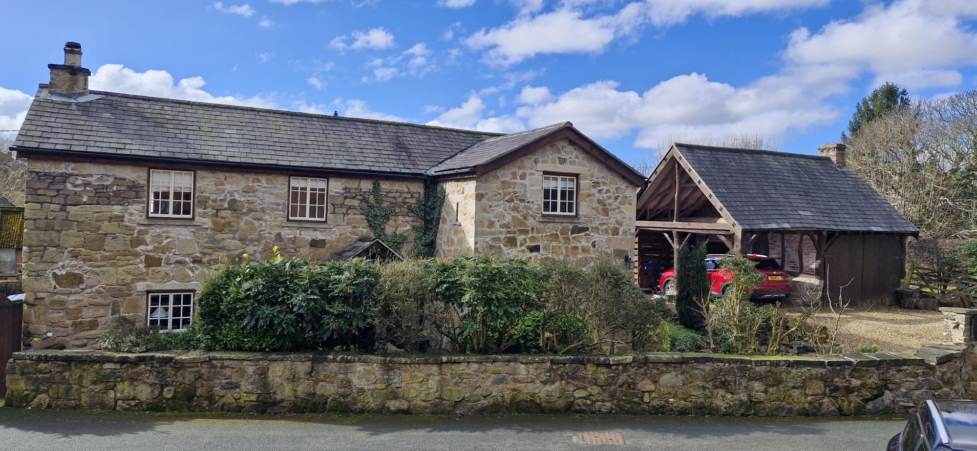
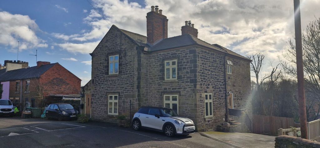
Rhuddallt Mill commands the corner of the road opposite Llys y Nant. The building was originally a working mill and is now a residential building.
On the right as the road rises is Mount House.

On the left is Rhagluniaeth Welsh Calvinistic Methodist Chapel, Providence Chapel, which opened in 1834.

Little Street dominates a corner of Tan y Lan next to the river.

We left the Tan y Lan area of the village with the Roundhouse directly opposite. The lock-up was built in the late 18th century to house overnight drunkards and minor criminals. It is a one room circular jailhouse. It was deliberately built adjacent to a public house for obvious reasons!

To the left of the Roundhouse is the Vaults on Bridge Street. Previously known as The Roundhouse and The Old Vaults Inn, it is now a pub and a B&B.

Attached to The Vaults is a Chinese takeaway. The building has housed many shops, and once attached to the side of it was WH Smiths!
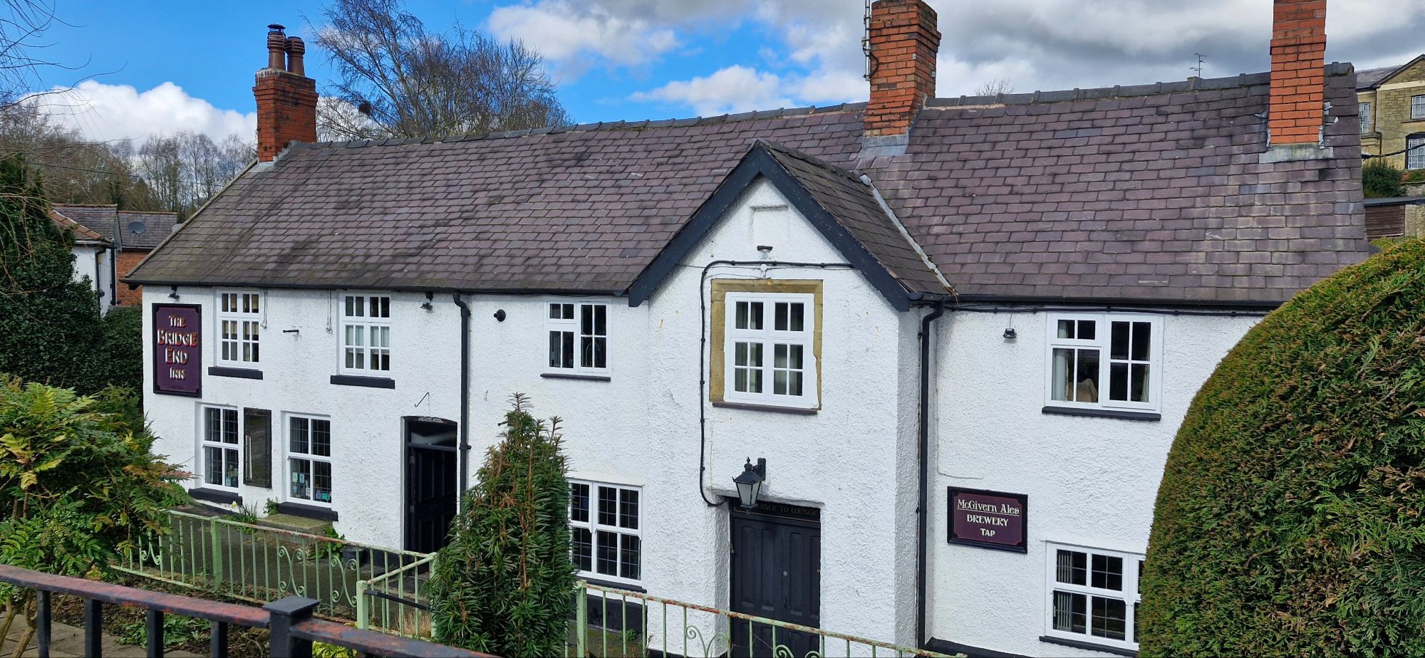
Further down Bridge Street is The Bridge End Inn at the opposite end of Ysgoldy Hill, where we were earlier. It was known as The Bricklayers Arms in the middle of the 19th century. It has previously been voted the Best Pub in Britain by CAMRA.

The rear of the pub has a nice beer garden, often used for outdoor entertainment.
At the rear of The Bridge End pub is a small area known as The Walks.
We continued over the road bridge and immediately turned right into Railway Terrace. The short lane has a dead end to it, and the cottages face the Afon Eitha.
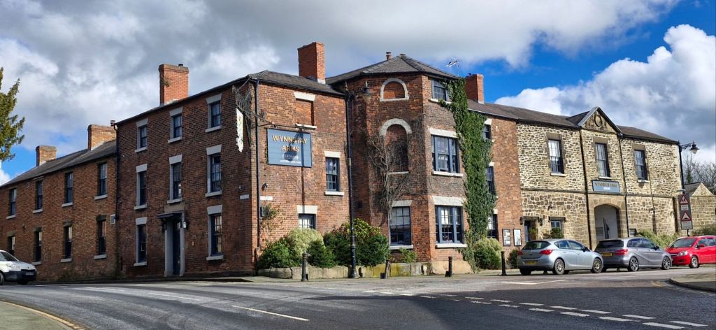
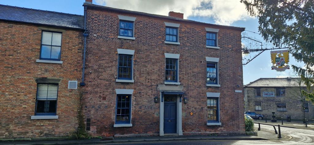
We headed back up Bridge Street to its junction with Park Street. The corner of the junction is dominated by The Wynnstay Arms. Built in the late 18th century, this old coaching inn is a large pub and hotel.

On the right, just below Park Street is a short row of cottages at Wynnstay Mews.
As we turned into Park Street, we entered an area known as Goat Bank, a small square that was once used for fairs and markets.

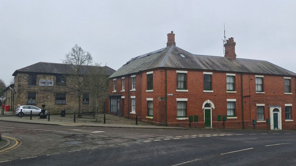
Ahead is the Con’s Club, the Constitutional Club and formerly known as the Village Room.
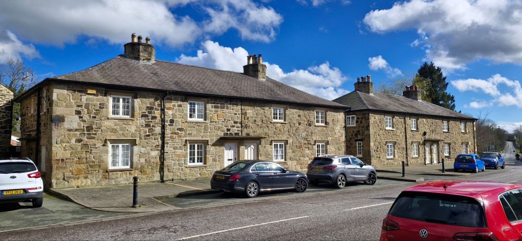
On turning right into Park Street, the wide street is lined with sandstone cottages on both sides.

The Gatehouse guards the old entrance to the Wynnstay Estate.
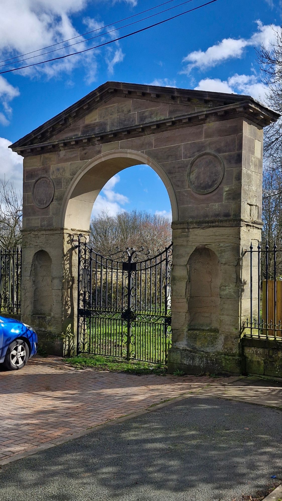
At the end of the street is the Wynnstay Arch, which was the entrance to the Wynnstay Estate. The drive beyond the arch was once treelined and led onto the estate. The A483 has disected the lane and made the gateway redundant. The gates were added on 1912 to celebrate the coming of age of Sir Watkin Williams-Wynn.
We turned around and headed back to the Wynnstay Arms, where we turned right into High Street.
The Wynnstay Arms can be accessed from High Street.

This end of the High Street once contained many shops and has only recently experienced the beginning of a rebirth with some refurbishment and redevelopment. The west side of the street is dominated by three storey Georgian houses.
A stone cottage stands next to the pub car park entrance.

Beyond the Wynnstay car park entrance is the old village bank. It was originally the North and South Wales bank and later the Midland Bank and finally the HSBC. It has been converted into flats.
Further along the east side of High Street is a row of houses known as Tai Clawdd. The houses were built in 1888 by the Yorke family of Erddig.

Bryn End, currently flats, concludes this block of High Street.
The boundary of the Conservation Area is drawn just after Fron Goch, a modern building that contains flats.
At this point, we ended our walk around the Ruabon Conservation area. We have probably missed commenting on some of the area, particularly the more modern buildings. If we have missed anything, we apologise in advance, but we can still make amendments if you let us know. Till next time!

great walk and a lovely village. Thanks for sharing!
LikeLike
Thank you for always reading 😀😀😀
LikeLike
That was brilliant. Originally born and bred in Ruabon I walked every day from the new part of the village to the Girls Grammar School. Went to the Congregatinal chapel from being born! Got married there and had our first son christened there. Looking forward to your next walk. Thank you xx
LikeLike
So happy that it brought back good memories 😌
LikeLike
Not all the pictures are up on the Heritage trail! Shame as it so interesting. My sisters loved the first one too.
LikeLike
Thank you for taking your time to read it and to comment 😊
LikeLike
Thanks Joe (and Malcolm for accompanying Joe on this walk so that he could pass on the interesting information about the Conservation Area of Ruabon)
I spent several happy years at Ysgol Rhiwabon and living in the next village but have learnt lots of interesting things about Ruabon after reading your account.
LikeLike
Thank you for your kind words, Jackie. I’ll get my human to walk around the rest of Ruabon before we move on to surrounding villages. If I can drag him off the couch 😆
LikeLike